|
Major Cities
Hualien City
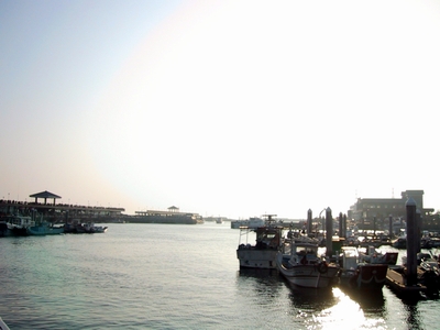
Hualien is the largest city in eastern Taiwan, and is the hub of transportation routes to all other parts of the island. Thanks to the world-class scenery of the nearly Taroko Gorge, Hualien attracts visitors from throughout Taiwan and the world. Many of the sidewalks of this city are paved in marble, which is Hualien's most famous local product.
Taitung City
Taitung City is located on the delta of the Beinan River, at the southern tip of the rift valley. In addition to offering transportation links to the rest of Taiwan proper, Taitung also provides ferry and air service to Green Island and Orchid Island.
Hsinchu City
The town of Hsinchu, now famous for its Science-based Industrial Park, was first developed in 1723. It was first called Hsinchu in 1875, and was upgraded to a provincial city in 1982. The Hsinchu administrative district include Shiangshan and covers an area of about 104 square kilometers. It has gained considerable prosperity and an international reputation since the creation of the Hsinchu Science-based industrial Park Hsinchu City is loacted in the northwestern part of Hsinchu Conty, its highedt point rising onlt 120 meters above sea level. The Hsinchu plain slopes upward to the east, and merges into Shrpajianshan and Nioupushan mountains. Most of the eastern part of the county is co-vered with foothills and small mountains.
Changhua City
Changhua is known as "the granary of Taiwan." Surrounded by mountains to the north, south, and east, the city faces the Taiwan Straits to the west. The area enjoys a mild climate with adepuate rain to make it an excellent agricultural base. Changhua's flower and shrub industry is particularly well-developed. During the Ching dynasty (1644-1911)immigrants from Fukien province first settled around Changhua.
Hualien City
Hualien is the meeting point of the Central Cross-Island Highway, Suau-Hualien Highway, and highways leading south to Taitung. Apart from the natural beauty of the city, Hualien also offers tourists many other attractions: the waterfront Seaside Park; Nanbin Park with its numerous marine sculptures, the "Hawaii of the East" Resort built in Polynesian style, reef walking and rock collection at Chishingtan, and the Buddhist Jingsz Temple. At 108 meters in height, Mt. Meilun is the landmark of Hualien; it is also the site of Jungjeng Park, and this provides fine views of the city. Facilities in the park include a children's playground, footpaths, and an old railway locomotive. The park also contains an exhibition hall with displays of seismographs that were used to detect earthquakes beginning in 1933 but have now been replaced by more modern equipment.
Ilan City
The city of Ilan is located in the central, and most favored part, of the Lanyang Plain. Streams and rivers provide a constant source of replenishment for the nutrients in the soil here, making Ilan a breadbasket county. The cultural, educational, and administrative heart of the Lanyang Plain is Ilan City, which is also a major hub for traffic along the northeast coast.
Taichung City
Taichung is the third-largest metropolitan area on Taiwan.It enjoys a yearly average temperature of 22.4. Cand a mild spring-like climate all year round. Taichung city is known as an educational and cultural center. Its commercial disirict,abundant cultura activities, and the warmth of its residents make Taichung an attractive city. The history of Taichung's development spans over 300 years. The Taichung City Archive displays a Chinese- language exhibition and explanation of the area's evelopment, Introductory pamphlets in Chinese and English are avaiable.
Nantou City
Nantou County lies at the geographical heart of Taiwan and is the only county that does not border the coast. Nantou covers an area of 410 square kiometers of mainly mountainous ountry. The county's abundant natural beauty makes it an excellent place for sightseeing. The area is blessed with a number of interesting towns, forested mountain, and clear streams at Shitou, Shanlinshi, Sun Moon Lake, and the Formosan Aboriginal Culture Village.
Chiai City
The Tropic of Cancer bisects the counties of Chiai and Hua-lien . There is a monument just outside Chiai City that marks its latitude. Some of the earliest pioneers from Zhangzhou in Fujian Province landed in Chiai and settled in the area near present Shingang . The inhabitants of the area remained loyal to the imperial govern-ment during the Lin Shuang-wen rebellion in 1786--a period of history recorded in artifacts preserved in Yimin Temple in Chiai. Chiai's attractions are mostly of cultural and historical interest. Foremost among these is Lantan , which used to be called "foreigner's stockade". This lake roughly covers an area of one by two kilometers and is shaped like a gourd.The lake was developed by the Dutch in the 1620s as a place to practice naval maneuvers, but it has now been converted into the main source of Chiai's water supply and a popular site for moon gazing during the mid-autumn festival.
Kaohsiung City
Located in the southern part of Taiwan,the city of Kaohsiung is the island's largest industrial center. It has stayed abreast of Taiwan's recent progress and prosperity; expanding and modernizing,the city strides into the 21st century as a newly emerging international metropolis. Beginnin centuries ago,Kaohsiung was called"Dagou" or "Dahgu,"transliterated from the name of local aborigines. Disturbed by the violence of pirates in the area, in 1563,the"Takuo"tribe eventually moved to the site of present-day Pingtungcity. This name persisted untill 1920,when the city's name was changed to Kaohsiung.
Kenting City
When the weather is fine and the great outdoors beckons, there are few resorts in Taiwan to beat Kenting for the wealth of activities on offer. Located on the Hengchuen Peninsula at the southern tip of Taiwan, Kenting is surrounded on three sides by water: by the Pacific Ocean to the east, the Bashi to the south, and the Taiwan Straits to the west. Down the middle runs the tail end of Taiwan's massive Central Mountain Range. The rugged coast has been shaped by centuries of erosion and offers spectacular views. The ocean provides some of Taiwan's richest fishing grounds, the coral reefs are a tourist's delight, and the weather a holidaymaker's dream. Kenting's subtropical climate means that the beaches are open all year round, and that the many forest reserves and recreation areas are full of amazing birds, beasts, flowers, and trees. Along the beachfront nightlife rages, with bars, discos, restaurants, and holiday resorts where visitors can party away into the early hours.
Penghu Island - Magung City
Penghu is known throughout Taiwan as an unrivaled source of delicious seafood, with a mind-boggling array of specialties such as grouper, lobster, squid, abalone, oysters, and dried and processed marine foods. Gems of the sea, including coral, seashells, and cultivated pearls, make ideal mementos of a visit to the islands. Among the best-known agricultural products of Penghu are loofah gourds, cantaloupes, peanuts, and seaweed cakes. The chief mineral product here is veined stone, of which Penghu is one of the world's two major producers (the other is Italy). The wavy, bubbly grain of this beautiful stone makes it ideal for the carving of name chops and decorative pieces of handicraft art.
Other Sceneries
Penghu: Magung Shrli Beach
Shrli Beach is a stretch of wind-blown sand and dunes more than a kilometer long. With its calm, blue waters, this the finest swimming beach on the main island of Penghu. The beach here is made up of fine grains of coral and seashell, making it a perfect place for walking in the sand, soaking up the sun's rays,swimming in the soothing water, camping, or simply enjoying a pleasant afternoon of quiet relaxation.
Penghu: Magung Hujing (Tiger Well) Island
Like Tungpan, Hujing is surrounded by column basalt cliffs, beneath which the water is exceptionally clear. Perhaps the transparency of the water here helps explain the legend of the sunken fortress. In the 17th century, it is said, the Dutch came here and built a fortress that later sank into the sea in the midst of a battle. Scholars who have come to explore the area in recent years have made no significant discoveries, leaving the sunken fortress a 300-year mystery.
Penghu: Magung Tungpan Island
Tungpan features a typical basalt mesa landform with a shoreline bounded by cliffs made up of well-developed, neatly stacked basalt columns. These spectacular formations have given the island its nickname: "The Yellowstone Park of the Penghus". A paved pathway circling the island gives access to its spectacular scenic attractions. On a sea-eroded platform on the southwest side of the island is a stepped basin, created by upwelling basalt lava, which is known as the "Lotus Terrace". The shoreline is given additional allure by a beehive-shaped basalt formation called "Cat Rock" Fuhai Temple, located near the dock. It is dedicated primarily to the plague god surnamed Wen, and its ornate decor helps make it the most popular temple in the outlying islands of Penghu. Large coral forests on the nearby seabed make this a fine spot for snorkeling.
Penghu: Magung The Sublime Craftsmanship of Tianhou Temple
Tianhou Temple is the oldest house of worship in the Taiwan area devoted to Matzu, Goddess of the Sea. Located in Magung City and originally built in 1592, it is listed as a third-class historic site. The temple was built by eminent craftsmen from mainland China and displays the highest level of artistic refinement. A small display hall on the second floor of the temple contains the oldest stone tablets in the Taiwan area, one of which records the expulsion of the "red-haired barbarians" (westerners who once briefly occupied Penghu) from the islands. Another artifact here is an inscription written on a commemorative tablet by the Ching Dynasty Emperor Chian Lung (reigned 1736-1796) in four gold Chinese haracters: "Merit Equal to Heaven". Magung, which originally carried the meaning "Matzu Temple", derived its name from Tianhou Temple.
Penghu: Magung Guanyin Pavilion
Guanyin Pavilion is an old temple situated on the shore of Penghu Bay and dedicated to Guanyin, the Buddhist Goddess of Mercy. Built first in 1696, the temple was destroyed during a war with France in 1884 and rebuilt in 1891. This third- class historic site is an easy walk from downtown Magung. Near Guanyin Pavilion is a large building of interesting European-style architecture, but built with local coral and basalt rock, which houses the Penghu Youth Activity Center. In the summer the nearby beaches are crowded with swimmers, sunbathers, and wind-surfers, and are also a fine place for watching the spectacular sunset over Shiyu Island.
Penghu: Magung Fengguei
The coastline in the Fengguei area is characterized by well-developed basalt columns, in which the action of the waves has eroded holes and sculpted other interesting formations. The pounding of waves forces water through blowholes in the basalt, forming spumes that look like steam spouting from a kettle--and, at times, producing sounds that give the area its name. Fengguei literally means "wind cabinet," or a kind of organ. Fengguei is popular with fishermen, who like to try their luck from the rocks. The nearby Lingde Wenwang Temple, devoted to a plague god surnamed Wen, has been there for 200 years and is also worth a visit.
Tainan Cuisine
Snacking in the City
Because of the culinary culture that has developed along with this ancient city, a tour of Tainan not only brings brandnew mental experiences but offers priceless opportunities to satisfy the palate as well. Among the many Tainan snacks that are known far and wide are coffin Cakes, bread in the shape of a coffin which has been hollowed out and stuffed; nutritious Passing the Lean Months Noodles, which weere developed by the fishermen of former times to help them get through the slack fishing periods; Pot-side Pancake Soup, made with rice dough spread on the side of a hot wok and scraped off in pieces; Rice Dumplings; Rice Pudding flavored with various sweet or savory lngredients; Eel Noodles; sweet Potato Pork Dumplings; Rice Cakes; Crystal Pork Dumplings; and milkfish Congee. These delicacies can be savored wherever snack ven dors congregate, such as the Hsiaopei Night Market and the Chinatown marketplace.
Tainan Confucian Temple
Established in 1665 as the first site for Confucian studies on the island, this temple is known as the "First School in Taiwan". This large and tranquil temple encompasses a total of 15 structures and was designed with the school situated to the left and the temple to the right. Impressive ceremonies to commemorate the birthday of Confucius are held in the courtyard in front of Tacheng Hall on Sept. 28 every year.
Tainan Great South Gate
The Great South Gate is one of the few remaining of the original 14 gates of the Tainan city wall. Built in 1736, it has an outer arched gate in the shape of a half moon, named Moon Gate. It is set at an angle to the inner gate because of security considerations. Located near the Great South Gate is the Forest of Tablets; a collection of ancient stone tablets that were gathered from various various places at the time of an urban reconstruction project during the Japanese occupation. These 61 different tablets, all of different sizes and ages, are of substantial historical value.
Tainan Old Fort of Anping
The history of Taiwan's development began at the An ping district of Tainan. This is where the Dutch built their stronghold in the 1620s, naming it Fort Zeelandia. Most of the old fort is gone now; the only bit left of the original is a piece of red-brick wall, with elegant banyan roots growing down its sides. Visitors here like to climb to the top of the observation tower (of recent vintage) to view the sunset and watch the fishing boats that dot the vast surface of the Taiwan Straits. In the old days, this was known as one of the "Eight Great Scenes of Taiwan".
Tainan Eternal Fortress
This fortress was built on the shore to help consolidate Tainan's sea defenses. Constructed in the late 19th century near the end of the Ching Dynasty, this square structure with high walls and a moat was the first Western-styled fortress on the island. The Armstrong cannon that provide the fortress's "firepower" today are replicas, manufactured in 1975, of the English originals.
Pingtung Wanchin Catholic Church
Wanchin Catholic Church is located in the small town of Wanchin. It was established by a Philippino priest during the Ching Dynasty. Completely restored in 1960, it is Taiwan's oldest church and qualifies as a third-class historic site. It has been called the "Holy Cathedral of Mary" by Pope Paul II. An inscription on a stone plaque inside, dating back to the Ching dynasty, implies the church was erected by consent of the Manchu authorities.
Kenting Jialeshuei
Located just outside the confines of Kenting National Park (about 8 kilometers north of Eluanbi on the eastern coast), Jialeshuei provides some beautiful coastal walks, along which coral, sandstone, and shale formations have been sculpted by wind and sea into an infinite variety of shapes. It is a wonderful place to go rock hopping, explore tidal pools, and enjoy the scenic beauty created by this unique combination of land, sea, and sky. A shuttle bus runs along this stretch of coast for those who would rather take a more relaxed approach. The waters around Jialeshuei are also suitable for surfing.
Kenting Forest Recreation Area
The entrance to the Kenting Forest Recreation Area is located 32 kilometers along the Pingtung-Eluanbi Highway. The park covers about 435 hectares, of which 76 hectares are open to the public. The more than 1,200 species of plants grown here are arranged according to type, with areas for medicinal plants, tropical fruits, rubber trees, and so on. There are 17 scenic points that are linked together by walkways, offering visitors maximum convenience to view both the plants and the scenery. Sites not to be missed include the Looking-glass Tree, which is over 400 years old, with unusual buttress-shaped roots that grow above ground; the Fairy Cave, a 137-meter-long cave of stalactites and stalagmites, lit up by lamplight; the observation tower, a 27-meter-high tower from which the southernmost tip of Taiwan and far away Orchid Island can be seen; and the Valley of the Hanging Banyans, whose walls, overgrown by aerial roots, form a wonderland all their own.
Chiai Night Market
According to local custom, the birthday of the Lord of the Somber Heavens is celebrated with swinging competitions and there is a wide range of local ceremonial activities on the sixth day of the third lunar month of the Chinese leap year. These celebrations are unique to Chiai. The Wenhua Road Night Market, which extends for almost half a kilometer, is a pedestrian area where all kinds of local snacks and delicacies can be sampled.
Alishan
The section of Alishan (Ali Mountains) with which most people are familiar is the Alishan Forest Recreation Area. Legend has it that over 250 years ago, a chief of the Tsou Tribe called Abali brought his people here after discovering these rich hunting grounds. The region was named Alishan after him. Alishan, in fact, encompasses 18 mountains and is a branch of the Yushan Mountain Range. The New Central Cross-Island Highway now links Alishan with the Yushan Scenic Area. The five wonders of Alishan are sunrise, sea of clouds, sunset, forests, and alpine railway--in addition, there is also the culture of the Tsou aborigines, which makes a tour of Alishan even more interesting.
Mt. Lulin Nature Park
Close to the Tatajia Visitors Center, Mt. Lulin Nature Park is a nice alternative for those who want to enjoy the mountain scenery without having to climb to the peaks of Yushan. It is easily reached and the trails of the area can be completed within one day. Facilities like the Shrshan Service Center or the Tatajia Visitors Center offer useful information and an introduction to the area,and well-marked trails with signposts make hiking very convenient. The main mountain in the area, Mt. Lulin, with a height of 2,881 meters, is about 1,000 meters lower than Yushan Main Peak and therefore much easier to climb. Upon reaching the top you will be rewarded with great views of the mountains of the Yushan Mountain Range.
Chiai: Tzengwen Reservoir
Tzengwen Reservoir is located between Dapu in Chiai County and Nanshi in Tainan County, Its dam was constructed in 1967, and is 133 meters high and 400 meters long. The reservoir has a surface area of 17 square kilometers. It took six years to complete this reservoir, the largest in Taiwan. The southwest coast of Taiwan is formed from stretches of sand banks, which the continuous blaze of the sun has made into salt flats. The town of Budai is the foremost producer of salt in Taiwan.
Chiai Salt Flats
The salt farms are busiest between the months of March and May when the sun is strongest and rain is scarce. Walking by the seashore one can see white mounds of sand and taste the salt as it is wafted inland on the wind.
The East Coast National Scenic Area
The East Coast National Scenic Area, known as "Taiwan's last unspoiled land", stretches 170 kilometers down the east coast of the island from the mouth of the Hualien River in the north to Shiauyeliou (Little Yeliou) in the south. To the east it is bounded by the Pacific Ocean; to the west rises the Coastal Mountain Range. The land here consists of volcanic rock, classic rock from deep beneath the sea, and shale that has been pushed upward- and is still being pushed upward- by tectonic action. Weathering, erosion, and accumulation have produced a wide range of landforms here, including coastal terraces, sand and pebble beaches, shoreline reefs, inshore islands, and capes along with sea-eroded platforms, trenches, and caves. This varied topography provides habitat for a rich diversity of flora and fauna.
The East Coast is the primary homeland of the Amis aboriginal tribe. Amis villages' dot the coastline, and the harvest festivals that they hold in July and August every year offer visitors an opportunity to gain insights into the culture of this unique people. Before the Amis settled here there were prehistoric peoples who came and went, leaving a rich store of artifacts and ancient sites that can still be seen today. Among the more modern cultural features of the coastline are enchanting temples, churches, and quaint fishing villages. This rich store of natural and cultural assets prompted the Tourism Bureau to establish the East Coast National Scenic Area in 1988, and to engage in the active development of the leisure resources here.
The East Rift Valley
The valley in eastern Taiwan that stretches from the plains of Hualien in the north to the plains of Taitung in the south separates the Central Mountain Range and the Coastal Mountain Range. The valley is where the Eurasian and Philippine tectonic plates come together, giving the area many fault lines and frequent earthquakes. The numerous streams and rivers that flow down from the high mountains have left vast alluvial deposits of sand and gravel where they enter the valley. Although it is difficult for vegetation to grow in the area of these deposits, which are extremely rocky and subject to unpredictable flooding or drought as well, the inhabitants of eastern Taiwan have been successful in growing many kinds of crops that give the valley a highly bucolic appearance. The affluent rural prospect of the valley has given it the popular sobriquet of a "green corridor" reaching from Hualien to Taitung.
Taroko Gorge
Located in Hualien County on Taiwan's east coast, Taroko Gorge is known for its sheer marble cliffs, deep gorges, winding tunnels, and the Liwu River,which flows through its craggy landscape. This landscape originated over 230 million years ago, when coral reefs formed in the tropical shallows where Taiwan is now located. Time transformed the coral into limestone, which the intense heat of geotectonic movements turned into marble.
The collision of continental plates four million years ago forced the rocks upward creating Taiwan's Central Mountain Range. Wind stripped away the topsoil exposing the rock to erosion. The flow of the Liwu River created winding gorges, rapids, waterfalls, and hollows in rock,which still bear the markings of the massive tectonic movements that created Taiwan.
Waterfalls are one of the primary attractions of Taroko Gorge. Many are located between the entrance to the gorge and Wenshan. Heavy rains send torrents cascading down the mountain in hundreds of transient waterfalls. These waterfalls are one of Taroko Gorge's most impressive sights.Generally speaking, Taroko Gorge refers to the 20-kilometer section of the Central Cross-Island Highway between the entrance to the gorge and Tianshiang. One of the most impressive sections lies between Yantzkou and TszmuBridge, where the road is carved directly into the cliff face and the sky is a narrow line of blue visible between sheer cliffs.
Taroko Gorge: Baiyang Trail
The entrance of the Baiyang Trail is located about 300 meters from Tianshiang on the Central Cross-Island Highway. Near Wenshan, hikers will come upon the tunnel that is the beginning of the Baiyang Trail.
Along the trail there are six tunnels of different lengths that provide a certain frisson as groups feel their way through the semi-darkness. The longer tunnels have solar-powered lights. This trail is particularly popular with locals, for it has an atmosphere of mystery and romance.
A turn in the trail at the end of the third tunnel offers an excellent view of Datszjili River, and at the end of the sixth tunnel the truly spectacular goal of the trail, Baiyang Waterfall, comes into view. The water roars as it plunges into the deep pool that it has worn in the rock. The Baiyang Suspension Bridge offers spectacular views of the waterfall and the river valley. A seventh tunnel leads to a cave behind the falls;because of the danger of falling rocks, this area is closed to the public.
East Rift Valley: Liyu(Carp)Lake
Carp Lake is located in Shoufeng Township, just south of Hualien. With an area of approximately 104 hectares, it is the largest lake in this region; its size caries somewhat, however, with the amount of rainfall.
The lake is encircled by a four-kilometer road that can be walked in about an hour. Popular activities include camping, picnic, and rowing on the lake. When the weather is favorable paragliders take off from Mt. Liyu just to the east of the lake, adding splashes of color to the green mountain landscape.
Hualien: Chrnan Forest Recreation Area
The Chrnan Forest Recreation Area is located on the mountain slopes to the east of Carp Lake. Its attractions include verdant forests, enchanting mountain vistas, and a pavilion area which provides excellent views of the lake. Facilities include a visitor center, forest paths, a grass-skiing slope, and a children's playground.
A cableway, railway engine, and other old equipment are preserved and provided with explanatory plaques to illustrate how this area once operated as a logging camp. In addition, there is a small forestry museum with exhibits, multimedia shows, and old photographs that illuminate the development of the forestry industry in Taiwan. Getting there: The location is 19 kilometers southwest of Hualien. If you travel by bus, get off at the Chrnan stop. By car, follow Highway 9 south to Shoufeng and Chrnan.
East Coast: Shrtiping
The shoreline at Shrtiping, which is situated at the 65-kilometer point on the coastal highway, was formed when volcanic rock worn smooth by sea erosion was uplifted in layers that resemble stone steps-which is just what the shrti of the name means. The geological structure here is made up of whitish-gray volcanic tuff that is strikingly different from the rock seen in other parts of the East Coast. A wide variety of coastal vegetation and sea lives make this an excellent place to observe the coastal geology and marine ecology. The Visitor Center at Shrtiping contains illustrations and explanations of the local topography, sea life, and vegetation that help make your visit more educational as well as interesting. There is also a campground where visitors may spend the night.
East Coast: Whale-and Dolphin-Watching Activities
The east coast of Taiwan faces the Pacific Ocean and is blessed with abundant marine resources.Many dolphins have been sighted off this coast,and migrating schools of large whaleshave been as well.Species sighted here include humback whales,blue whales,sei whales,grey whals,killer whales,etc.Now whale-and dophin-whatching has become a new eco-tourism activity in eastern Taiwan.
Hualien: Rueisuei Hot Spring
This is one of the three top hot spring spas in the valley, the other two being Hungye and Antung. Rueisuei was first developed in 1919, with a public bathing area and Japanese-style hotel; and it is still in operation, with an open-air pool where visitors can enjoy a soothing soak and enjoy the fresh air at the same time.
The spring water emerges from the ground at 48 degrees Celsius and is rich in iron; the iron oxidizes upon contact with the air and gives the water a yellowish tint, causing some first-time visitors to mistakenly think that it is unclean. The water has a slightly salty (indeed, salt crystals float on its surface), rusty taste; it is the only carbonate hot spring in Taiwan, and bathing in its waters is said to be an effective treatment for rheumatism and allergy-type skin conditions.
The Changhung (Rainbow) Bridge
The Shiouguluan River, the largest river on the East Coast, empties into the Pacific at the 68-kilometer mark of Highway 11. The river is spanned here by the graceful, 120-meter-long Changhung (Rainbow) Bridge, this is the first prestressed concrete, support-free bridge in Taiwan. The bridge offers a commanding view of Shibulan Islet at the river's mouth, where isolation has given rise to a unique scrub vegetation ecology. This islet is now designated as a nature preserve. Changhung Bridge marks the termination point for rafting trips down the Shiouguluan.
Green Island
Green Island, or Liudau, is a 16.2-square-kilometer piece of jade-green land that rises from the Pacific Ocean just 33 kilometers east of Taitung. It is home to 3,300 islanders.
Composed of volcanic rock and having a heavily eroded coastline, Green Island possesses a fascinating variety of land- and seascapes: odd rock formations, rugged cliffs, a white-sand beach, verdant pastures, dazzling coral reefs, and a unique seawater hot spring, as well as a quaint and easygoing lifestyle seemingly left over from the distant past. These resources are rapidly making Green Island the oceanic playground of the East Coast. An 18-kilometer round-the-island highway gives access to all the major tourist sites, making it easy for visitors to tour Green Island by foot, bicycle, motor scooter, or automobile.
Orchid Island
Like Green Island, Orchid Island (Lanyu) is a volcanic island that was formed of magma erupting from the ocean floor. Because the peaks of the mountains at the northwestern corner of the island resemble red human heads in the crimson rays of the setting sun, it was formerly known as "Redhead Island." The present name refers to the wild orchids that once grew there in abundance. The humid, rainy climate has cloaked the mountainous interior of the island with a thick rain-forest cover, and has provided it with a countless variety of plant and animal life. Coral reefs are distributed around the island and the warm Japan Current also flows by, attracting vast schools of fish that make this a paradise for deep-sea fishing and skin diving.
We Love To Hear From You!
Other Sceneries
Link to Taiwan!
Link To The Offical Taiwan Tourism Information |